Scoring of 23m geocoding results
My last project at Grata Inc. involved the development of an automatic evaluation method to determine if geocoding results from external APIs (Geocode Earth, Mapbox) looked wrong and needed revision. Geocoding means that a raw address is converted into structured data of a location: the city, the state, the country, etc.
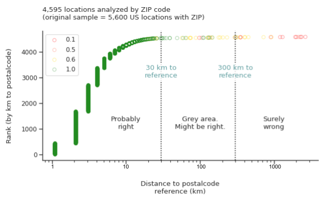
With this purpose, I designed a scoring method for US geocoding results that leveraged on on public data from the ZIP codes present in the raw addresses. A simple score where the correctness of the state and city weighed differently was combined with the distance in kilometers between the ZIP data and the geocoding result, which included latitude and longitude. A couple of decision rules with thresholds tuned after analysis of a large sample proved effective to quickly decide if a given API result was trustworthy, highlighting a tail of bad results that those APIs gave for some corner cases of noisy addresses.
This evaluation was performed on 23m existing records in the database, as well as being implemented as a new step in the evaluation of incoming geocoding results.